Showing posts with label Thai Verzone. Show all posts

Friday, May 25, 2018

Golden Age Nostalgia

After reading Luc Mehl's guest blog at the Alpacka web site I indulged in some nostalgia from 2009-2010.

If you're reading this, then you really should go read Luc's post. I found it flattering and a bit of a vignette of what I, self-centeredly, consider the Golden Age of packrafting.

Golden in that it was a big leap forward. Golden in that Brad Meiklejohn urged us into Embick's  Class IV and V creeks. Golden in that real boaters Tim Johnson, Paul Schauer, and Thai Verzone led us down and plucked us out. Golden in that I started hitting whitewater centers beyond Alaska with the boat born in Alaska and now ready for the world: NZ, Grand Canyon, Australia's Franklin, Appalachians.

But the world was not ready. Haters were everywhere and even Alpacka wanted nothing to do with thigh straps.

"Why would a packrafter being going down a class 3/4 river like this, ever? Not only that, these guys are wearing drysuits because the water is cold - and I can't imagine a lightweight hiker wanting to bring one along on his trip. 
Seriously, I think you've missed the point of this video completely. It's about paddling in big groups that have sufficient resources to perform a rescue and using the skills that are taught in whitewater rescue classes properly. It's not about boat design.
I've kayaked big water for years and backpack/hike and the combination of packrafts and big water is a bozo no-no in my opinion. It seems like the packraft community is rediscovering everything the ww kayak community has known for years about the dangers of ww kayaking. Please stick to class 1 rivers and ponds for your own safety, and don't paddle in cold water without the proper thermal protection."

And a kayaker's response to thigh straps and packrafts in 2009. 

 ‘In a packraft, at least IMO, they seem like more than is necessary even at the upper end of whitewater. IMHO if you feel you need thigh straps you should probably think about improving your technique or further developing your skills. Weather it be reading the water better and seeing the clean lines and hitting them or simply spending more time in the raft, one needs to have skills. Given their design, there are just certain things that will be difficult no matter what you do. eg big holes on big water. These things are already about as idiot proof as it gets. Don't get me wrong, there are probably a hand full of people that could really push what is possible in a packraft with thigh straps, but for most it will simply be a substitute for skill and ultimately not help them in the long run. In fact I'd be willing to bet that most packrafters would not be able to roll a raft even if they were glued into the thing. It is certainly more difficult than a kayak by a long shot. Not to mention much harder on one's shoulders as well.’
But maybe like bad brush and cold water, some of us just felt that these nasty-grams were challenges to overcome and now that they are overcome, I find myself sitting back, older, and trying to just get out of the way.

  1. My Packrafting! book is out of print.
  2. Falcon Guidebooks sells a new book about packrafting.
  3. Thor and Sarah Tingey have transformed Alpacka with a boat for every kind of water and even a mountain bike boat.
  4. There are maybe even a dozen other packraft manufacturers.
  5. My testosterone has drained away leaving me somewhat flacid when it comes to whitewater.
  6. But it doesn't matter because there are plenty of bad-asses out there, 
    • including former kayakers and
    • hard-core packrafters-first who now use kayaks to improve their packrafting.
It's been great to watch and even greater to be part of it.

My own history with whitewater in packrafts can be covered in six videos. The first couple of videos are sort of accidental. But starting at the end of  2008, 2009, 2010, and 2011 I posted on You Tube the greatest hits I'd been involved with each year. 

2008 was the year of whitewater discovery. 
2009 was the year of whitewater exploration.
2010 was the year of thigh straps that made us feel like real boaters.
2011 was the year of extended sterns that felt like cheating.

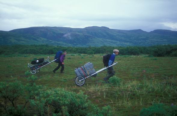
(January 2000) Taking a Sherpa Packraft down a stream in Pumalin Park, Chile before I'd actually got my butt in an Alpacka.


(January 2008)  Hermit to Havasu with Gordy and Cody Roman in the Grand Canyon. Up to say 2008, Cody Roman and I going down Ship Creek's canyon repeatedly and sniffing out some other runs elsewhere, was about it for whitewater. Then I started paddling with Brad.


(2008)  was the year I finally found someone other than Cody Roman who wanted to do Ship Creek more than once. The music was Radiohead's National Anthem, a song and band Roman introduced to me and the song captured the hectic feel of the early days of whitewater in packrafts. But YouTube stripped the song....so now it's the canned version of what they offer.


(2009) By the Fall of  2009 the packrafting revolution was getting started with Brad, Thai, Luc, Gordy, Tony, Becky, JT and others hitting it hard in Southcentral AK. It was when Tim Johnson and Paul Schauer and Thai Verzone, Class V kayakers all, joined us.

These guys, as Mike Curiak recently wrote, made me feel as though they were "participating in an entirely different sport -- one filled with grace and control and poise, where by comparison I feel like I just bludgeon and hack my way through while trying to survive."


This one doesn't play on phones, I guess because nobody's made enough money yet off the half-century old Beatles classic, Revolution (although it plays on computers in the US). It's worth watching on a 'puter, by the way, with the sound track.


(2010) Ah yes, the struggle with Alpacka over thigh straps. We were the Devil:  dangerous, reckless, a real pain in the butt-boats of Alpacka, but in the end we were right. Maybe, just maybe, our devilish ways got the "Witchcraft" started, a black boat you might catch a glimpse of in this next video somewhere, and that is the ancestral boat of Alpacka's Lips and Gnarwall boats. Or maybe it was really the handful of "Media Feliz" paddlers down in CO that motivated the development. Still, I like to think it was us, the 20 or 30 people in Alaska packraft-paddling Six Mile and Little Su and Ship Creek and Bird that pushed whitewater boat development at Alpacka. But again, probably just my narcissism playing tricks on my ego!


(2011) With the new long stern boats of 2011 it was almost a new sport. It was like in the 1980s when sticky rubber (particularly the Fires) hit rock or when foot fangs and plastic boots hit ice, or when leashless tools hit both rock and ice, whenever that happened. We had the new longer stern boats that erased bandersnatching as a concept and instead launched us out of sticky holes, leaning forward into the modern boats we've known for years. It also ended my year-end video making recaps, as then Luc Mehl and Mike Curiak were there to pick up my stringy end of the tapestry and weave it with finer artistry.


And there we have it. Six footnotes to "Show up and Blow up: Alaska"!

Saturday, July 19, 2014

Adventures in Tibet: Five Treks, Two Koras, a Packraft Loop and a High-Altitude Train Ride

Looking for ice worms in Tibet was tough.

First there was the lack of good maps. I had a handful of old Russian military topos at the 1:250,000 scale. Horribly out of date, with unpronounceable names in an unreadable language made them not too good as road maps, and the contour intervals combined with the extraordinarily steep terrain made them good for little more than dreaming.

The best nav tool was an iPad Mini, cellular version that has a GPS, combined with Gaia GPS. Gaia is an iPhone or iPad ap that allows you to save images and maps to device disk when you have an internet connection and then acts as a GPS with those images/maps when you are away from cellular or other connections. It is a game-changer for wildland travel when maps are hard to get.

Second was what's needed to find ice worms: warm, wet glaciers in the dark during the summer monsoon. This meant hiking up muddy trails to yak pastures to make a camp. Then building a cairn chain across the moraine in the afternoon, generally between 14,000 and 15,000 feet; the best cairns were three rocks with the middle rock contrasting with the outer rocks, reflective white being best. Then hiking up slippery bare ice, hopping crevasses and getting above snow line as darkness fell with rain, now at about 16,000 feet, to stumble around in the darkness looking fruitlessly for worms. Then stumbling back down across the glacier, trying to follow our cairns across the moraine by headlamp in the dark and rainy mist after midnight, back to our tent, or maybe a cabin if we were lucky.

Third were the Chinese police and their Tibetan informers who eyed us Western foreigners suspiciously, as they have watched Western foreigners for maybe a half millennium or more. With tension between Chinese and Tibetans, Chinese and Americans, and the general xenophobia of superstitious mountain people isolated from others by Himalayan mountains, rivers, gorges, and glaciers (their dialects were hard for our Lhasa guides to decipher), we were hassled every few days and eventually chased out of the region and back to Lhasa by the authorities who did not trust what we were up to.

I'd scouted out potential ice worm locations as glaciers in the Yarlung Tsangpo drainage. The Yarlung is the primary Himalayan watershed, draining the north side from as far away as Everest, and runs east a thousand miles before cutting the arguably deepest gorge in the world past Namche Barwa, last 25,000 foot peak to be climbed (1992). Swinging south past Namche Barwa, the Yarlung flows into the Indian state of Arunachal Pradesh (which Brad M. visited after the Megalaya Show up and Blow up) and becomes the Brahmaputra. While hundreds of miles from the Indian Ocean, the summertime high pressure air lifting off the Tibetan Plateau sucks warm wet air off the Ocean as wet, summer monsoon winds. These winds bring daily afternoon thundershowers as they rise up the Brahmaputra and Yarlung valleys, making the region luxurious in conifers and glaciers, like a beefy Cascades or BC Coast Range, but twice as high and three times the distance to the ocean.

The main valley we followed was T-shaped and two hundred miles long -- more if the western extent -- totally off-limits to foreigners -- were accessible. The valley we wanted to visit is called the Yigong Tsangpo and it has been off-limits to climbers chasing granite spires rising off the biggest glaciers in the eastern Himalaya, kayakers looking for the steep-creek style but Grand Canyon scale rivers, and trekkers after untouched Tibetan nomads in lush mountain forests. It is also the valley reputed to have the Tibetan ice worm.

Using Google Earth we'd found a half-dozen 3-4 day trips that went from the road to 16,000 feet or at the firn line on monsoon glaciers.

The first was near Gyala Peri. We all went as far as a meadow filled with blue poppies the first night and then all but one of us went to the yak pastureland between glaciers, and then Thai and I went up to the glacier between Sendapu (22,349 ft) and Tiba Kangri (22,460 ft), to prime ice worm habitat.

Bridge across Wrong Chiu on the way up to glaciers in the Gyala Peri Range

The entire expedition on our first hike: we had one horse for the eight of us.

Mike in the low mid elevation birch forest.

Could be Alaska: log cabin with elder-berry

Iris and something familiar in yellow.

So familiar yet foreign: cabins, conifers, and cloud


The part of Tibet that looks like Alaska

Thai follows a yak trail bordered by willows.

Bear track -- this bear killed a yak calf.

This pasture was bounded by two glaciers and a mountain. The 35 yaks were herded by two young girls and an old man.

Yak camp below Sendapu (22,349 ft)

Pasture camp view -- spruce and steep, Himalayan headwalls.

Young yak herders up for the summer.

Tibetan hospitality. The radio played music off a USB stick.
On the fire is milk being heated to make butter.
Hanging above the fire pit is dried cheese on a string.
The girl was 18 years old.

June young.
Making yak butter tea, Tibetan style.

Heading out for the night.

Most glaciers are fed by avalanches from high above.

Thai went for simple spires on prominent rocks as cairns (on rock to right of him). Not always identifiable as cairns in the dark, though.

Excellent ice worm habitat but without any ice worms.

Looking for a spot to wait until dark.

North American ice worms like these creeks during the day.

Where we hung out for hours until dark, sheltered from the rain.

Marking our high point on the first of two glaciers we visited that night.

Future yak pastures?

Huge avy cones and moraine rubble.

It would soon start raining all night long.

Hanging out, brewing up, staying dry, waiting for dark.


This trip set the pattern: we'd drive to the valley coming out of the glaciers we wished to visit and make camp at the end of the road. Then our guide would talk to some locals who'd bargain for horses, if we wanted them. Then we'd pack light and head up in the morning, taking most of a day or more to get to the last yak meadow before the glacier moraine. This meant we'd encounter herders, up high for the summer, who'd share salty tea, yak butter, rock-hard dried cheese on a string, and if we were lucky the best yogurt I have ever eaten and maybe some greasy yak-meat stew.

After the first trip Thai and I were usually on our own, without any language save pidgin-sign. This meant for some good times with locals as we tried to explain where we were from, where we'd come down or up from, what we were doing.

Friday, July 18, 2014

A Month in Tibet

Last summer, July 2013, Thai Verzone, Mike Tetreau and Prof. Dan Shain and I went to southeastern Tibet, the part that doesn't look like what you'd expect Tibet to look like. And we went in June and July when most Himalayan trekkers don't go. Why don't they go in summer? Because the summer monsoon winds bring wet weather every day and the shining mountains the walkers want to see are hidden.

Southeastern Tibet in June looks more like the Cascades in winter than the Himalaya in summer.


We also went to Lhasa, the place that looks more like your imagination -- yaks and prayer flags, no trees, rounded mountains with smooth, polar glaciers, yurts and nomads, the high grasslands of the Tibetan Plateau. But we spent just a week there in high Tibet, if you will, at the end, after three weeks in the Yarlung Tsangpo's tributary valleys.

Potola Palace at night from our hotel in Lhasa


This was the third time I'd gone to the tall, glaciated mountains of Asia, the largest alpine tundra expanse in the world, I'd guess.

A Himalayan tundra plateau steaming after a summer monsoon shower below Tsima La (16,200 feet)


Summer 2012 Young Roman and I visited Bhutan.

Tiger's Nest: Taktsang Monestary


 Summer 2011 Thai and I went to far western Yunnan Province, where China bumps up against Burma and Tibet at the headwaters of the Mekong River.


 Each of these trips we searched for the Tibetan ice worm. While we we unsuccessful with ice worms all were enormously successful otherwise.


Friday, June 6, 2014

Arrigetch Creeking 2012

Aiyagomahala Creek (aka South Arrigetch/Hot Springs Creek) at the end of the long Class III section and just above the Class IV.


For a number of years I wanted to fly into the Alatna Valley with a basecamp and big group to explore the many creeks that radiate (see last map) out from the Arrigetch Creek area. In a 20 mile stretch of the Alatna there are four creeks on the river left bank (Nahtuk, Pingaluk, Kutuk, Unakserak) and another four on the river right bank (Awlinyak, Arrrigetch, Aiyagonahala, and Takahula).

The idea was to hike on the wonderful game trails and ridges then float down the various creeks. I’d walked down the Nahtuk in 1986 with Peggy and packrafted its lowest reaches, but also marveled at its inner canyons. In the early 2000’s Thor and Ralph Tingey and later a trio of PJs packrafted Unakserak. In 2010, Andrew Skurka and I walked down the Pingaluk valley on wonderful animal trails while I drooled over its splashy rock garden canyons. Without a drysuit, PFD, helmet, nor partner similarly equipped or interested in running its Class III looking water, I regretted not paddling it. I’d also spent a month in the late 70s rock climbing in the Aiyagomhala Valley, and walked up Arrigetch Creek and over to Awlinyak a number of times: all three of those looked good for some boating, too, and in 2010 Dave Weimer packrafted Awlinyak. In a blog post I measured the gradient for all the creeks, too, and saw that there was potential from Class I on the Alatna to Class V on Aiyagomahala, Arrigetch, and the upper reaches of Awlinyak Creek.

After pricing out our options, it was most cost effective for nine of us (me and Peggy; Gordy Vernon; Toby Schwoerer; Mike Curiak; Ole and his brother Dennis Carrillo; Kim Mincer and Joe McLauglin) to drive to Coldfoot and fly with Coyote Air ($1596 for 1250 pounds) on wheels to a gravel bar near the mouth of Arrigetch Creek. After a week the pilot Dirk Nickisch returned to pick up Ole, Dennis, and Peggy and left Thai Verzone, Cliff Wilson and Stefan Milkowski. After the second week, Mike, Kim, Joe and I flew out from a gravel bar strip a mile and a half upstream of Aiyagomahala Creek (aka Hot Springs Creek and South Arrigetch Creek) while Gordy, Thai and Cliff walked the 80 miles to Anaktuvuk in 4 days -- Pingaluk to Kevuk (packraftable) to Walkaround to Yenituk (tussocky!) to John River (more tussocky!!) and Toby and Stephan walked to the Haul Road more leisurely.

We had bear barrels from nearly 3 to 30 gallons; a bear fence; a nine-person bug net shelter; a shade/rain tarp; basecamp food, clothes and tents. We had the sunny promise of June in the Brooks Range before Solstice, with, hopefully few bugs and lots of runoff.
 

Ultimately we had the sunshine and few bugs (until late June when rain and bugs arrived in force), but not really enough water for everything. In fact, Pingaluk and Nahtuk were dry (only inches deep); Kutuk (Class II+), Awlinyak, (Class III-) and upper Aiyagomahala bony; Arrigetch (Class IV) and lower Aiyagomhala (Class IV+) just right.

Generally we enjoyed great animal trails and relatively benign brush on one to three day trips out of basecamp (BC). We were able to make two summits combined with overnight camps and packraft floats out:
 

(1) a long day trip up and down the Kutuk (6 mile hike followed by a 6 mile Class II+ float down Kutuk and 1.5 miles on the Alatna). Highlights are views of the Arrigetch and fun little boulder gardens on the Kutuk.

(2) an overnight via Peak 4200 on the Unakserak (12 mile hike + 9 miles on Unakserak + 8 miles on Alatna). Amazing summit and fun climb up this peak prominent to the NW of our base camp. Some really good ridge walking connecting Kutuk and Unakserak valleys.

(3) a two night trip up Arrigetch Creek, over 6600 foot Ariel Peak and out Awlinyak Creek – possibly the best three day trip I have made (17 mile hike over 6600 foot summit + 14 miles on Awlinyak + 8 miles on Alatna). Gordy said the summit view was the best he'd ever seen from a mountain-top, looking out at the Arrigetch Peaks all around us. The creek was spalshy and full of grayling too. The weather perfect.

(4) an overnight down the Alatna, up Pingaluk via 2100 foot bluff, and over ridges back to BC with stunning views of the Arrigetch (4 miles on Altana + 22 mile hike over 3900 foot peak). Disappointed that there was no water in Pingaluk. The best whitewater landscape route in Gates of the Arctic would include this creek after the John River and finishing with a hike into the Kobuk headwaters for some lightly loaded rafting toward Walker Lake and maybe beyond.

(5) a day trip up Arrigetch Creek for an "instant classic" run of Arrigetch Creek that ultimately disemboweled my boat with sharp schist (3 mile hike up 1.2 miles + 300 vertical foot Class IV + 2 mile hike out). Until I cut my boat this was the most fun mile of packrafting I may have ever had. Comparisons to Ship Creek, Magic Mile, and Little Susitna were inevitable. A pool drop schist canyon w/big granite boulders too that thinned out near the bottom exposing the razor sharp rocks. The U shaped cut was maybe 2 feet long and reached from deck to hull. Bummer!
 

(6) a three day trip from BC to upper Aiyagomhala and out to the Alatna (25 mile hike + 8 mile paddle including a 200 ft/mile Class IV+ section) for pickup where some of us walked and some of us rafted and those rafting found exactly what we were looking for: challenging whitewater like Little Su in lightly loaded boats. Hot springs and beautiful bedrock waterfalls and slides on upper Aiyagomhala ("Little California"). Not enough water and some ugly stop rocks at the bottom of the drops in the "Little California" section of Upper Aiyagomahala. After the rain we could have put in at Hot Springs and ran from there but instead walked a mile or so downriver and put-in there to run nearly constant Class II and III to a mile or so with five Class IV and above drops, all of which we ran.

Going in earlier than we did (we were there June 16-30) could mean better water from snowmelt and even fewer bugs (some of us never used bug dope for the first twelve days); July would have bad bugs (as discovered by those who walked out first week of July); August would be hit or miss with water and would have dark nights, but pretty colors.
 

Spending a month in an Alatna basecamp with rock gear (see
 http://www.stanford.edu/~clint/arrig/index.htm) as well as elbow pads and face masks and beefed up packrafts could be even more fun: Rainy? go boating! Sunny? go climb granite peaks!

There are plenty of steep creeks left on both sides of the Alatna (as well as clean lines on rock). For example Upper Aiyagomhala and the lime-section of Arrigetch (i.e upper canyon -- we did lower canyon) have some obvious Class V+ potential. We left those drops for the next-gen packrafters.


Thursday, August 16, 2012

Packraft Festival 2012: Brooks Range Basecamp


Last year, 2011, 15 of us flew out to Pt Heiden and traversed the Alaska Peninsula to Chignik over Aniakchak. It felt like a packrafting festival and several of us hoped to replicate the big group in wilderness and packrafts again, although Aniakchak's frequent flier miles would be hard to beat (all 15 of us went for "free" last year).

This year, a bunch of us -- including Gordy, Thai, Toby, Ole, Joe and me -- convinced others to come. Thai convinced Clif, Toby convinced Stephen, Ole invited his brother Dennis, Joe brought Kim and I convinced Peggy and Mike C that a basecamp  in the Alatna Valley would be fun for all, Class I-V.

Scheduling for late June, so as to miss the bugs and maybe catch some run-off, worked surprisingly well -- although we needed a bit more water. Some of us went 12 days without bug dope or head net, although the five who walked out in early July hit the bad bugs head-on as they walked to Anaktuvuk from the Arrigectch.

We ran six creeks and rivers and made four summit walks and scrambles, doing wonderful overnight and three day trips out of a luxurious, bear-proofed basecamp near the mouth of Arrigetch Creek on the Alatna River in Gates of the Arctic Park. We hiked and boated and bathed and scrambled and fished and ate well and had fun in the sun. It was neat to have a tent set up to come back to and take a minimalist approach to the overnights in real wilderness with superlight packs, adjusting the gear and food as we learned what worked and what we forgot.


There were great animal trails and no tussocks, firewood and a bit of rain to bring the highlight run up to a good packraftable level -- Aiyagomahala Creek (aka "hot Springs" and "South Arrigetch" Creek) below the Hot Springs. Above the Hot Springs are wonderful drops (Class IV-V) and boulder gardens and even granite slides, but low water prevented us from running much of the upper highlights. Below the Hot Springs were a couple hours of Class III and then a 200 foot a mile section of Class IV+ with five Magic Mile/Little Su type drops, all situated in a beautiful valley of steep walls and spruce forest.

Arrigetch Creek's lower canyon was Class IV bedrock pool drop filled with big granite boulders for boat scouting. Unfortunately the bedrock is schist and as we (Toby, Joe, and I) got lower in the canyon the granite was less abundant and sharp rocks became apparent, eventually disemboweling my boat :(

Awlinyak was super fun, mostly Class II (a spot or two of III-) with an approach directly over a scenic Arrigetch peak called Ariel. The climb is an amazing, improbable scramble and Gordy said it had the best view of any summit he's been atop. We did that loop in three days, two nights, sleeping at the Forks of Arrigetch Creek and at the put-in for Awlinyak.


Unakserak also had a neat scramble on our way to its Class II shallow canyon. It has been a good float for parties coming over the tussock fields east of the Alatna, toward John River and Anaktuvuk, but not the only choice: Kutuk and Pingaluk are more sporty.

Kutuk is an odd, orange color due to a permafrost blow-out in its headwaters according to Dirk of Coyote Air. It is  Class II+ and a bit more appealing if travelling over from the tussock fields. We hiked up and ran its lower five or six miles.

Best looking of all (but too low for us, although I scouted it w/Skurka in 2010) is Pingaluk. Coming from Anaktuvuk and floating the John all the way to Wolverine avoids the tussock fields (mostly -- until heading into the upper Pingaluk for an hour) and offers up the most sporting of the three mid-Alatna creeks (Unakserak, Kutuk, Pingaluk) looking like Class III on beautiful polished boulder gardens. As a consolation prize (we ran none of Pingaluk) on the way back from Pingaluk we climbed a bump overlooking our base camp  for a beautiful view of the Arrigetch.

Overall it was a great trip with 12 days of sunshine and two of rain, great people and good food.

We flew in and out with Coyote Air after driving north on the Dalton to Coldfoot -- much cheaper than flying out of Bettles via Fairbanks.

Next year, I am thinking a road-based trip between Honolulu and Healy along the Parks Hwy: there are like 15 fun creeks and rivers from Class I to Class IV including the Bull, the three forks of the Chulitna, Honolulu, Jack, Cantwell, Windy, Sanctuary, Riley, Nenana's multiple sections, Moody, and more. A scheduled two weeks with planned events like "Class IV Fridays" and "Class II weekends" in June before the Classic, and open to all who want to come, sounds like a good plan for the 2013 Packraft Festival.

Anybody interested in that?


Sunday, September 25, 2011

Upper Willow Video

Like a junky needing a fix and desperate for a source, I left a message on Timmy J's voicemail Friday afternoon:

"Timmy, do you know any kayakers who'd be up for Upper Willow tomorrow?"

Luc and Toby were interested if I could get more merriment in the form of more boaters. On the phone I told Thai that it was the best boating I'd done all summer, like the way Ship Creek used to feel back in the days before everyone knew that packrafts are real boats, and that he'd love the low flows and pool drops.

"OK, I'm in. Text me when and where."

Then I called Brad M, JT L and Joe McLaughlin, striking out with all three.

But Timmy came through, surprisingly passing up on the weekend's massive flows on Six Mile that the hard shell boaters were hitting again. Paul Schauer loaned him his 2011 red Llama.

So with Luc, Thai, and Timmy, two cameras, warm fall weather, around 225 cfs in Upper Willow and a little video from last Tuesday's romp on that creek with Tim, Trip, Johhny C, Matt P, and Bo I put this together -- it's worth watching twice to see Luc's combat roll and Thai's boof without thigh straps, as well as a real boater putting a red-colored, thigh-strapped 2011 Llama to the test.


After the run we did (only as far as just above Triple Drop), Timmy said, "You know, these new boats are awesome. So stable and fast. Harder to get airborne on a boof, but so nice on the landings. I'd leave my kayak behind and just take one of these to New Zealand. And putting a slab of minicell foam under the seat worked really well, you should try it."

So there you have it: packraft advice from a real boater.

Friday, September 9, 2011

Hiking and rafting between 6,700 & 15,500 feet in Meili Snow Mountain National Park, Yunnan, China


Dr. Yonde Cui of the Chinese Academy of Sciences and I picked Thai up at the airport in a 4x4 Mitsubishi with our Tibetan driver; climbed out of Shangri La over a pass; dropped down along the Yangzi and the Sichuan Border; then back up and over another pass (14,000 feet) to Deqen and Feilaisi, about a dozen miles as the raven flies from Tibet

The 200 km took six hours and we passed through country dry and scrubby, wet grasslands, oak, pine, larch, spruce, and fir forests, as well as yak grazed tundra.

About half the road was under construction and all of it was impressively perched along steep slopes.

The next day we drove down to around 6700 feet, crossing the Mekong River in its wildly steep Canyon (when do mountains become canyons and vice versa?), the color and volume of the Colorado at a good medium flow in the Grand Canyon, climbed up along a a desperately precarious one-lane road a thousand feet above, bumped along that to the driver's home town of Xidang, then hiked from 8,700 feet over a 12,000 foot pass into the Yubeng Village country where we started looking for ice worms above the yak meadows and talus slopes.

We looked hard, visiting a couple of Byron Glacier-style, but Himalayan-scale, avalanche cones by day (meltwater caves) and night (surface and crevasses), camping at 12,500 feet and climbing to a glacier at 15,000, nearly getting our heads blown off by a rock the size of a shipping box for the MacBook Pro 17 inch.

Back to Feilaisi and a happy hostel, we then drove north as close to the Tibetan Border as we could (20 km) without permits, then turned south again and scouted our most ambitious ice worm traverse -- up a side valley of the Mingyong Glacier to "Yak Herder" Glacier at about 15,500 feet, then over a col and across a second, dead glacier, and around on yak trails back to where we'd started.

On our last day we packrafted the Mekong River for a short bit -- very apprehensive as there are huge rapids and vertical walls in combination which we wished to -- and did -- avoid.


All of the peaks in the Meili Snow Mountain Range are unclimbed (with at least three over 6,000 meters) or at least they are unreported, as the range is sacred to Tibetan Buddhists. If we'd had time and permission we'd have made the 150 mile pilgrimage route (Kora) around the mountain range using packrafts for at least a section on the Salween.

This was my first time to Tibetan Buddhism country and I was taken by the people and their culture and how it's so interwoven with the landscape and nature in general. The culture was as delightful as the mountains were beautiful. I now know why so many westerners hang prayer flags at home and others become Buddhists.

We had 10 days of sunny weather and met only sunny people, including the possy who chased us down.


Thursday, September 8, 2011

"Rescue" from Minyong: One Trip Report from Yunnan, China


Trails without sign posts, the Red Bull Trail, the first 24 hours, not just interested in you but respecting and admiring you as you do them, the police kid, the wildly waving man, the guy with the scratch on his leg, the park ranger (or superintendent?), the Yak Herder, the tame yaks, the yak herder's hut, the sketchy climb past the lowest waterfall, the sketchy bushwhack past the upper waterfall, avalanche gullies scraped down to bedrock and slick alpine tundra, the spacey head above 14,000, the crushed rhododendron that stung my nose like a soup spice did my tongue, bushwhacking through rhododendron mixed with birch and bamboo, zig-zagging down-trails through meadows ringing in yak bells, the deep bark of a mastiff a thousand feet below, giant hemlock five feet across with bear claws and the police boy tumbling off, jumping a cascade with the steaming maw of an ice cave just below, wondering what was to come of us, the cell phone call in the rhododendron to a female voice on the other side speaking English, the Yak Herder who looked like my Uncle Zinn and scrambled up a leaning birch to get better cell reception, his pack full with a liter and a half bottle of home made liquor, fry bread, herbs and roots and orange phallic mushrooms, and the furry genitals of a black Asian bear, with great pantomime stories of the hunt and the function of its medicinal powers.

The moraine ridge leading to the moraine covered in heather and lichen and dwarf rhododendron, flowers and plants like those back home and those we didn't know. The good solid rock five four maybe leading to where we could step onto the glacier with a view 7000 feet down to the Mingyong Village below. The Ranger's and Yak Herder's route discussions. The Yak Herder's speed and agility in soft green shoes with no apparent tread, his glee in pointing out our up-tracks in the dust of thar and yak trails, his excited voice on the phone announcing us, his discovery. The mixed birch and hemlock forest with an understory of rhododendron. The texture of the glacier, its headwalls and layered rock, its cracks. And the smooth, thinning icefall now ice ramp that fed it, the firn with no ice worms at 15,500 feet. The pass and the pika and thar tracks to the next glacier, it dead, no cracks, just white and black, handsome long tailed pipits like snow buntings picking slow crawling midges off the surface, but no worms. Huge boulders precariously balanced, posed to pin a leg, if not an arm, the glee of stepping onto tundra and following trails past bivy caves, huts, flowers and views in the shade of morning cloud after a week of high altitude sunshine had toasted my lips, the runs at 15000. Sleeping on everything I had, waking at 2 am for a jet boil brew. Scouting the route on the tourist boardwalk and walking with David, a Chinese researcher studying Tibet architecture. 7 hours up from the hut, class V and VI bushwhacking and climbing with class II brush as desperate handholds, horses in town walking the streets, tucktucktuck of a tractor, and horses looking for goodies like a sweet plastic bag on the street, gentle people living with their animals horses pigs and yak-cattle all tame and pettable. Little orange cats and massive black dogs on chains. Fear of rain, crossing yawning meltwater gorge on avalanche debris of old snow, rocks and a forest peeled from the hillside. Boulders marked with the year the glacier had passed there -- a km in five years of retreat. Scouting through binoculars handing them back and forth seeing the same routes Thai describes, splitting up to take trails see where they go, reporting, then debriefing. Squeezing melted fun sized bars into our mouths eating slightly stale chips from split bags and unbroken fresh ones from bloated bags. Coffee and poptarts for breakfast, red rhododendron flowers, fir trees, spruce trees, pine trees two kinds of hemlock, larch trees, cottonwood and aspen, a tinge of yellow up high but summer down low, tashi delay to dark-skinned-almond-eyed people and nee how to white-colored ones on horseback, everyone skinny, everyone happy, the long looks from Han women as we walked past shirtless, pointing to leftovers on tables for dinner (no language other than survival sign), popsicles and Beer at trailhead when all five "rescuers" leave but Police-boy and we not yet congratulating ourselves, going to the police station and again the English speaking female voice on the cell saying that we will not be fined but to "leave town as soon as possible", this spoiling our plans to packraft through town on the Minyong Glacier's runoff stream. Police-boy and the border guard drunk and staggering down the street, terraces from above, yak foothills, river gorge gardens and fields, high mountains for worship and life giving waters from ice and snow above.

The Yak Herder mimes how rocks fall his arms waving akimbo head shaking tongue rolling out eyes closed hands ringing his own neck, the lands above yaks are dangerous. He stops in His downhill run to show poison plants and dig for herbal ones. He tells us with hands milking and holding fingers to head and then pumping an imaginary pole that he is a yak milker and butter maker happy and smiley and fast uphill and down and jumping his fifty year old body (he looks) across waterfalls and gorges, slipping effortlessly down slimy slides and tangled thickets. He makes me feel cautious and slow and THAI falls several times the only time I see THAT. Police-boy his slouching down the trail his hat sideways his jacket hanging loose off one shoulder. The border patrol guy waving furiously to go his way and yelling my way off. Cameras and cell phones in their hands in the bush in far SW China. Sharing cigarettes and chocolate, building a little hut to show that we need to get stuff at the hut where we'd left gear hidden and a small bag of food hanging like an offering that they had accepted, and lots of wood and a clean space, they'd seen our headlamp lights and five had come looking and found us.

We didn't really know where it was, nor how to get to it, but the Red Bull Trail was down there somewhere, and then we found it, soon after the Yak Herder found us, eating raspberry crumble from the bag and drinking water from the creek, in Yunnan China one mile maybe two from Tibet, on mountains, unclimbed and unclimbably sacred off-limits to us, with no worms on their glaciers, alas, we have to come back to the high wet mtns of China again and we will.

Sunday, August 14, 2011

Aniakchak Caldera


Amazingly the 15 of us walked in over three different days and in all of kinds of weather.

Being of the magical belief -- or maybe a trans-rational one -- that the entire universe and we are one, which in practical terms means if your group gets along well then the weather is great -- we had Thai and Monty and Suzie and Joe and so our weather was fantastic on the walk in.

In fact the only time our weather was wet and nasty was the day we eight headed over a pass toward the coast away from the big party group and there were a bit of disjointed discussions about where we should go and about what pass is which and whether on the 1:250,000 scale quadrangle maps for Alaska whether the big squares are five miles or six across.

Saturday, August 13, 2011

Aniakchak Party: Pt Heiden to Chignik Lagoon

Back in the 1980s Aniakchak National Monument was just too far away for my twenty-something dirtbag packrafter budget.

This was before Alaska Airlines offered Pen Air as a travel partner and before Thor Tingey showed that the Gates of Aniakchak's Class IV rating did not apply to packrafts (ah, another example of how packrafts deserve their own rating system! But I have given up on that battle to move onto other more important ones -- like universally dry spray decks).

Thor eventually took his Mom (Alpacka's Sheri Tingey) and Dad (former NPS superstar Ralph Tingey) from Pt Heiden to Aniakchak Lagoon, initiating a rush of early acceptors to follow suit. This wasn't quite a cheap, dirtbagger's trip, just yet, as it it required a $2000 charter flight out from the Lagoon.

I wanted to do a loop coming back on the Meshik and walking the Bering Sea coast back to Pt Heiden (like big rafters do, as the walking from Aniakchak to Meshik Lake area is awesome on crow berry flats of cinder ---- big boaters even bring wheeled carts for their portage!), but Brad Meiklejohn suggested walking to the Chigniks (Chignik Bay, Chignik Lagoon, Chignik Lake), another 65 miles on and flying out from there -- on Alaska miles.

Somehow the small initial group of JT and Brad plus Luc, Sarah, and Anthony swelled to Brad, JT, Luc, Sarah, Anthony, Este, Brooke, Toby, Ole, Joe, Gordy, Thai, Suzie, Monty, and me. Somehow all 15 of us managed to get flights into Pt Heiden and out of Chignik Lagoon within days of each other. And somehow we all managed to meet at Surprise Lake in the caldera for a party that lasted two nights, included day hikes all over the Caldera with several summits like Vent Mountain, plus a day of flipping the Gates Class III rock gardens, which failed to cut any boats, despite well over 20 descents with and without loads. And somehow we all managed to gather round one big bonfire after the 20 mile whitewater stretch and dry out and eat popcorn.

Luc has posted some pics and so has Toby. Others will soon, no doubt.

I was most impressed with the coastal walking and with traveling as a group of eight (Toby, Ole, Joe, Gordy, Thai, Suzie, Monty, and me) to Chignik Lagoon. It was refreshing to share food again after a string of trips with people who only feed themselves with their individual cook pots and food-in-a bag. We had 14 hour camps and lots of long breaks.

When we moved, we moved fast, often trying to keep up with the athletes of our group, Toby (who held the Crow Pass record for a while) and Suzie who seemed to be all leg.

When the tide was low we walked the beach and when it was high we walked world class bear trails. And I mean world class! I can now see why Hig has taken Erin down the Alaska Peninsula twice.

Willow fires in the rain were a real highlight of the rafting and driftwood fires on the beach for the walking. We only cooked breakfasts on stoves in the rain in the Caldera and eventually went to all campfire cookery -- a real packrafters' trip it was. We used the boats on each of the eight days except the first two leaving Pt Heiden and the first day of beach walking. One day we used them twice: first on Kujulik Bay and then on Dry Creek.

We had great weather, some rain, and friendly locals in Chignik who gave us dry wood, half a case of beer, and cooked us king salmon steaks smothered in cream cheese.

Overall the trip felt to many of us like a Wilderness Classic, minus the race part and with lots of sleep, rest, and fun -- very social yet wild. Many bears, most big, all shy, but occasionally scary as you'll see in the video.

Pt Heiden to Chignik Lagoon is now on my list as a fat bike ride, taking my 2011 Super Scout (extra six inches longer and with mylar/spectra spray deck) for crossings and brushy low land creek bottoms where the walking is bad and the creeks give beach access. I ran the Gates twice in my Super Scout wearing rain gear and all the rapids downstream too. It's an excellent wilderness travel boat, also very Retro with its 10 inch tubes, a foam pad for a seat (Z-Rest), and lots of bag paddling and ferying to take the driest line.

Here's a video of the beach trip. It's long and includes voice, sort of new territory for me. I hope it's enjoyable for those who didn't go -- I made it for those who did.


Tuesday, July 12, 2011

East Fork of Iron Creek: 24 Hours to Talkeetna


The bike buzz didn't last as long as I'd hoped.

The siren call of whitewater quickly washed away the rubber residue and almost immediately after getting home, I was paddling that Super Scout (a 2011 Alpacka Scout w/six extra inches and a super cool, center opening, spectra-reinforced mylar spray deck) places it wasn't designed to go.

Doom wanted whitewater after the Magical Mystery Tour and our local goodness delivered. Then Ganey came to town and had to hit the highlights including a near 10 foot gage run on Six Mile's lower two canyons with Timmy J, Luc Mehl, Todd Tumalo.

Wow! What a wild ride Six Mile at 1400 cfs in a packraft is. But the 2011 Llama is almost like cheating. The stern is like a spring that propels you out of holes and the bow punches waves. The bottom is a new and lighter fabric so I have beefed it up with more fabric, especially in the foot and seat areas.

The deck on mine was a special order with a heavier fabric and a very short center opening and mondo velcro. It's not for everyone, and requires a bit of worming to get into and out of on shore/in eddies. When flipped and under water I sometimes use the rip cord to get out, since I am fairly securely installed in that boat.

But the new design, which took the best of the proto-type Wichcraft and incorporated those features (pointy bow, long stern) into the basic line-up, feels almost like cheating. Good bye to the "bandersnatch", hello to catching eddies easily and ferrying fast. Good bye to most side to side bow sway. Hello to straighter, cleaner lines. And boofing is a blast!

Because I am a Yak-sized guy paddling a Llama with seat forward, lots of air behind me, thigh straps, and a super deck, my boat stays dry and buoyant in bigger and squirrelier water. It's not a beginner's boat, especially with a load inside.

But when Joe McLaughlin called about the East Fork of Iron Creek in the Talkeetnas I jumped at the chance, especially with the all-star team of Joe, Thai Verzone, and Tim Johnson.

For video reasons I wanted Tim and Thai in packrafts, but Timmy came equipped with his hardshell, ostensibly fot the flat water paddle out the Talkeetna. Joe's a hardsheller, and so is Thai, but Thai and I have been making annual stabs at establishing the boundaries of packrafting since 2008 when we did Bird, then 2009 when we did Montana and the Happy with side trips.

Thai and I would find that the East Fork of Iron would again raise the bar.

As for mixing hardshells and packrafts I have followed Tim in his hardshell down New Zealand's Upper Hokitika and Six Mile when it's an iced-up, gnarly little creek. I'd welcome his skills, strength, safety, and good sense if he came along in nothing more than a dry suit and kick board.

Joe, too, is a solid boater, who took me down Six Mile many years ago in a mixed group of kayaks, both hardshell and inflatable, as well as canoes paddled by experts who could roll them, and me in my old red Yak.

Eyeing my long, svelte 2011 Llama, he said, "It looks like packrafts have evolved to the point where they don't need to be dumped every ten minutes and can run side by side with kayaks."

The steep Blueberry Canyon on Iron Creek's East Fork would prove that statement true.

Many apologies for the apparent narcissism of the video below. Because we boat scouted nearly everything and were racing darkness, there was no opportunity to use the "big camera". Moreover, the ole' dental cam was missing its face mask extension and I had to go with a bow mount for the Go-Pro. The bow mount doesn't work so well filming forward, but does work well facing back....hence the video.

Timmy J, Thai and I drove up to Talkeetna after feasting on Peggy's moose and razor clam tacos with another stop in Wasilla at Sr. Taco: the idea was to feast, fly, and paddle till midnight.

The flight in from Talkeetna to the miner's airstrip took 25 minutes and $600 for the four of us in Talkeetna Air Taxi's Beaver with two hardshells shoved in the tail.

At first the stream was so scrapy and braided I wondered whether there'd be enough water to cover the rocks we'd seen from the air in the crux Blueberry Canyon. When the creek entered a mini-canyon but felt pretty much just like the South Fork of Eagle River, I wondered why I had shelled out $150 for a fly-in version of Hiland valley.

Then, an hour and a half after putting in, the canyon deepened, the creek steepened and the wild ride began.

I'd been expecting a bedrock canyon, like Bird or lower Ship, but instead got an hour and 15 minutes of twisty turny boulder drops -- not smooth and rounded like Little Su or Magic Mile, but sharp-edged and sievy like the last three drops on Honolulu or Montana below the Big Sky drop.

Almost immediately into the main event of the run, Thai was wondering about the "spray deck leaking" on the stubby Llama I had loaned him.

In classic Thai style he was paddling this modern Alaskan steep creek in a dry suit loaned to him from someone in Gustavus (when he and Gordy had headed back over the Fairweather Range to Yakutat after walking and packrafting the beach to Gustavus), with a paddle loaned him by Tim, and in a loaner Llama of mine.

He had only had time to outfit the unfamiliar boat at the miners' airstrip using the camping gear he'd brought. We'd forgot to bring a backrest for a boat with the seat moved forward.

So when the water got stiff and steep and he found himself swamped, the creeking was not exactly enjoyable for him.

None of us could afford to tip over in the shallow, maybe 175 cfs flow.

I was glad for elbow pads, face mask, and a stable boat. And for Timmy's boat scouting skills. Several times he'd eddy hop right to the edge of a blind drop while we clung to the canyon walls waiting. He'd crane his neck, then pivot and drop in, with one hand over his head signaling us to follow.

At one point in the crux rapid slalom, among giant boulders that strain water and wood out of the flow, Joe got hung up in a corner.

Thai came by him from behind, saw the predicament then screamed and hooted like a banshee.

Downstream there was no mistaking that wild alarm sound as an exhilarating hoot and Tim was paddling hard upstream into an eddy with his spray deck pealed back, exiting the kayak in one smooth motion to pull Joe and his boat to better waters.

Another sieve drop from hell where a landslide filled the creek had one thin line that Joe made smooth and sweet to redeem himself but the rest of us walked.

Besides that and a log below the canyon and a couple fresh wood falls on the Main Fork of Iron Creek we ran everything.

Pulling into our confluence camp at midnight, we were giddy and glad, even after discovering that it wasn't the spray deck on Thai's boat that leaked, but rather a six-inch butt split. In fact whatever cut the boat had also sliced his dry bag inside the boat, too!

Despite the damage and the scare, the East Fork had delivered with a tight, technical, twisty-turny and very steep canyon that kept me right on the edge of my abilities, but never freaked me out, never had me feeling out of control.

"A little more water, like maybe another hundred cfs, would actually make it easier. Pad everything out and make the lines cleaner," Timmy said.

"Yea, I'd love to come back and run this again with more water," responded Joe.

As for me, the low water was perfect for a packraft. And I'd like to get back to Disappointment and drop a few ledges that we portaged last year, before I return to Iron Creek.

The two Talkeetna tribs are certainly related, like big brother and little sister.

Neither is granite: both are sharp. Neither is easy: both are modern, fly-in, AK creeking.

E Fork Iron is like a sassy, slappy little sister to Disappointment as big, brooding brother, mellow in the boogey water but bossy in the drops.

Disappointment is very committing, set deep in a steep-walled, alder-encrusted canyon. E Fork Iron is a shallow canyon with tundra and people at a cabin and airstrip above. Portaging and retreat seem an option.

Disappointment has a handfull of Class IV/IV+ punctuating hours of boogy water; E Fork Iron has an hour and a quarter of non-stop III+/IV/IV+ and a V- slalom sieve. The filler is almost all III+ in Blueberry Canyon.

The confluence camp is nice and the 14 mile 2.5 hour paddle to the Talkeetna's tan waters down the milky blue Iron Creek is quick, fun and smooth. Great wave trains in fast flow make for cushy paddling.

In Timmy J's guidebook he quotes those from the first descent as calling the run "an absolute classic".

If Embick had run it and put it in his book, Fast and Cold, he'd have to give it five stars.

E Fork/Iron/Takeetna has the wilderness qualities of the Happy and scenery as good as the Charley, with craggy granite upstream and forested valleys down.

Awesome whitewater.

And certainly at least three type of river in contrasting segments: the clear water unique steepness of E Fork; the milky blue wave trains of Iron Creek; and the tan big water of the Talkeetna.

Hopefully this video can tell some of our story.

 
/* Use this with templates/template-twocol.html */