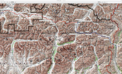
By the way, every square on the 1:250,000 quads below is six miles (i.e., 10 km, not five miles as some seem to think).

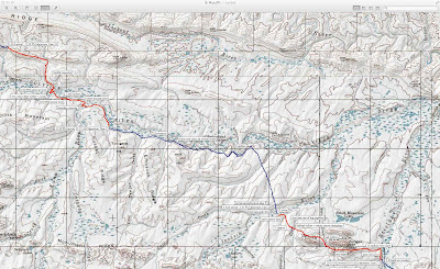
Walking up the Wulik was second choice. First choice would have us leave from Pt. Hope but bad weather prevented us from landing there.
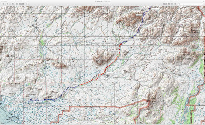
Crossing De Long Mountains we saw much wildlife -- wolverine, bears, caribou, birds -- but not too scenic.
Fantastic walking on these ridges. Best a little below on subsidiary ridges that offer water to drink and less exposure to blasting wind.
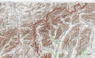
After Ryan left, we headed east into boggy, tussock uplands between Colville and Utukok. Following the Colville wasn't much better.
Lookout Ridge was great walking. Saw another wolverine here.

Among the worst travel of the trip: tussocks off Lookout, swimming the Colville and Ipnavik, more tussocks, mosquitoes, and the first shin high willows. Also the remotest spot in the USA.
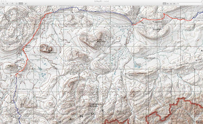
Bugs came out as green up hit so thankfully this was fantastic ridge and gravel bar walking.
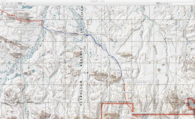
The stretch into the mountains and across them to the Killik and beyond followed caribou trails for 20 miles, non-stop. Perhaps the longest continuous animal trails I have followed.
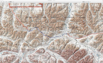
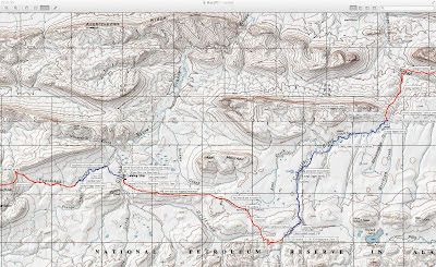
The grind into Anaktuvuk started fast then bogged down in tussocks and wet willow brush.
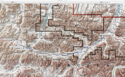
This is the Anaktuvuk to Haul Road stretch. Solo, fast and a bit sentimental. Also radically scenic.
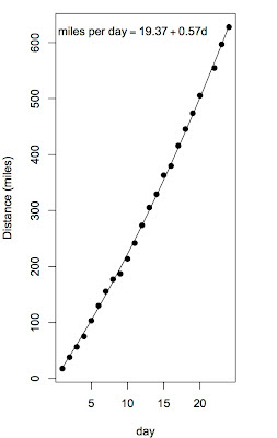
So here's a little R graph. I plotted our cumulative distance as function of day since start, the fit a quadratic through the points and the origin after finding that the intercept was not significantly different from zero.
Even before that the curve was a nice fit, with an R-square of "triple nines".
So the quadratic gave me where we were from the start as a function of day, so the derivative gave me speed as function of day.
So on average we made 19.37 miles per day + 0.57 (miles/day/day)* days. That is, we accelerated as our packs lightened up by about 0.6 miles per day each day.
Not what I'd expected exactly, 25 years ago when I first dreamed a trip like this up, but heh.


